


UNION TOWNSHIP, Huntington County, Indiana
About
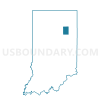
Outline

Summary
| Unique Area Identifier | 577890 |
| Name | UNION TOWNSHIP |
| County | Huntington County |
| State | Indiana |
| Area (square miles) | 36.31 |
| Land Area (square miles) | 35.63 |
| Water Area (square miles) | 0.68 |
| % of Land Area | 98.13 |
| % of Water Area | 1.87 |
| Latitude of the Internal Point | 40.87372110 |
| Longtitude of the Internal Point | -85.39282030 |
Maps


Graphs
Select a template below for downloading or customizing gragh for UNION TOWNSHIP, Huntington County, Indiana


Neighbors
Neighoring Voting District (by Name) Neighboring Voting District on the Map
- CLEAR CREEK TOWNSHIP, Huntington County, IN
- HUNTINGTON 11A, Huntington County, IN
- HUNTINGTON 12A, Huntington County, IN
- HUNTINGTON 13 (NV), Huntington County, IN
- JACKSON TOWNSHIP 02, Huntington County, IN
- LAFAYETTE B, Allen County, IN
- LANCASTER TOWNSHIP, Huntington County, IN
- ROCK CREEK, Wells County, IN
- ROCK CREEK TOWNSHIP, Huntington County, IN
- UNION, Wells County, IN
Top 10 Neighboring County Subdivision (by Population) Neighboring County Subdivision on the Map
- Huntington township, Huntington County, IN (20,837)
- Jackson township, Huntington County, IN (4,043)
- Lafayette township, Allen County, IN (3,354)
- Union township, Wells County, IN (2,138)
- Clear Creek township, Huntington County, IN (1,928)
- Rockcreek township, Wells County, IN (1,579)
- Rock Creek township, Huntington County, IN (1,350)
- Union township, Huntington County, IN (1,235)
- Lancaster township, Huntington County, IN (1,150)
Top 10 Neighboring Place (by Population) Neighboring Place on the Map
Top 10 Neighboring Unified School District (by Population) Neighboring Unified School District on the Map
- Southwest Allen County Metropolitan School District, IN (39,119)
- Huntington County Community School Corporation, IN (37,124)
- Northern Wells Community Schools, IN (15,184)
Top 10 Neighboring State Legislative District Lower Chamber (by Population) Neighboring State Legislative District Lower Chamber on the Map
Top 10 Neighboring State Legislative District Upper Chamber (by Population) Neighboring State Legislative District Upper Chamber on the Map
Top 10 Neighboring 111th Congressional District (by Population) Neighboring 111th Congressional District on the Map
- Congressional District 5, IN (809,107)
- Congressional District 3, IN (723,633)
- Congressional District 6, IN (676,548)
Top 10 Neighboring Census Tract (by Population) Neighboring Census Tract on the Map
- Census Tract 9613, Huntington County, IN (4,625)
- Census Tract 9617, Huntington County, IN (4,546)
- Census Tract 9620, Huntington County, IN (4,254)
- Census Tract 9616, Huntington County, IN (3,726)
- Census Tract 402, Wells County, IN (3,717)
- Census Tract 117.01, Allen County, IN (3,354)
- Census Tract 9618, Huntington County, IN (3,230)